
Geo-ten 2026 Report
28/04/2026
Hello.
I'm Rio Ishii (roz), a B4 student in the Kawaguchi Lab.
This is a report from Geo-ten 2026, held on April 28, 2026 at a hall in Otemachi, Tokyo.
In addition to me, the lab members who joined were masashi, kamijo, aoi, haru, teru, tamu, and shoji.
About Geo-ten
Geo-ten is a joint exhibition for companies, student groups, and other organizations working with maps and location information. It started in 2016 and has grown a bit every year.
According to the organizers, this year's attendance was about the same as last year (over 1,000) or a little higher.
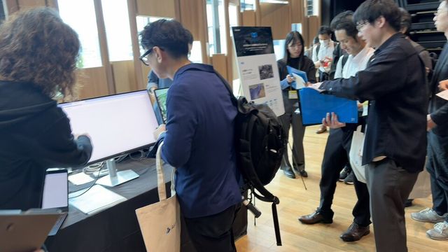
We were lucky enough to get a booth this year, where we exhibited some of our research.
Our exhibits
Our booth was themed "Area and mobility modeling and its applications using only mobility big data". We showed the following projects:
- Area / user modeling: A method for learning distributed representations of how areas are used from stay information, and modeling human trajectories as sequences of "area-vector transitions".
- OpenUAS: An open dataset of area embeddings for eight major Japanese cities (Tokyo, Osaka, Nagoya, Fukuoka, and others).
- Future urban mobility prediction (LP-BERT): A Transformer-based mobility prediction model that has placed multiple times at the HuMob Challenge (2023, 2024, 2025) at ACM SIGSPATIAL.
- "Local-knowledge AI": A knowledge-graph-backed AI system that answers natural-language questions about urban space, with results shown on a map.
- 3D urban activity map from 3D mobility data: A study of estimating building shapes and visualizing underground areas in Nagoya from 3D mobility data.
- Synthetic mobility generation and city-scale simulation: An application that generates ~240,000 agents (about 10% of Nagoya's population) while preserving the characteristics of real mobility data.
- Local information collection: An AI system that collects experience-based knowledge from residents and tourists through dialogue.
We didn't get a slot for an oral presentation this year, so we mainly explained the flyer contents to visitors at the booth. A lot of people stopped by and we had a lot of good discussions. aoi's local-information-collection framework was especially popular and got a lot of interest.
A fair number of people were also curious about the vector-embedding approach to area and user modeling, and we got some interesting suggestions about how it could be applied to urban planning.
Geo-compe
Instead of an oral presentation, I (roz) entered Geo-compe, the competition held alongside the exhibition.
I presented our work on building-structure estimation from 3D mobility data. It didn't quite fit the theme of the competition this year and didn't win a prize, but it was a good chance to present the work outside the lab and get feedback from a different audience.
Reception
In the evening I went to the Geo-ten reception.
The most memorable part was a long conversation with someone from MetCom. The main things we talked about:
- What they want the data to be used for: Applying it to urban planning and partnering with consultancies. They also mentioned that it could be useful for designing evacuation routes during disasters.
- Where the data is going: They're working on calibration, and a future release will cover the same area but with about 7x more valid devices.
- A possible collaboration: If the work matures into a clear theme, they'd be open to a joint research project down the line.
Partway through the reception, students were asked to make a short "ambition statement" in front of everyone, which was pretty nerve-wracking. masashi and I were told afterwards by the organizers that we "spoke clearly and at a good length", which was a relief.
Other booths I enjoyed
I didn't attend Geo-ten last year, so I can't really compare it to previous years, but here are the exhibits I personally enjoyed.
VIRTUAL SHIZUOKA
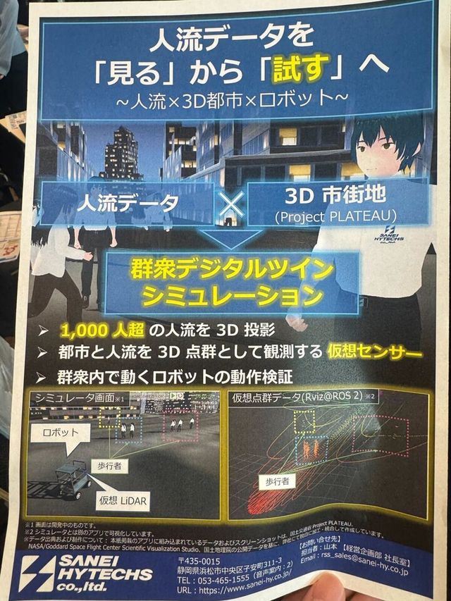
A project run by Shizuoka Prefecture to scan the entire prefecture in 3D. They've collected about 500 billion points of 3D point-cloud data, using airborne laser scanning (LP) and mobile mapping systems (MMS), and released it as open data under CC BY 4.0.
What I liked was how broad the use cases are: damage assessment by comparing before/after point clouds, 3D simulation of tsunamis and river floods, autonomous driving, virtual tourism, landscape planning, and more. It made me think that combining our "dynamic" human-mobility data with this kind of "static" 3D structure could lead to much more detailed urban analyses.
Geospatial platforms
A lot of companies were showing platforms for integrating and serving geospatial data, rather than just selling one type of data on its own.
- Kokusai Kogyo's Geozén / PAREA-API: a base for integrating geospatial information and serving it through APIs.
- Pacific Spatial Solutions: bringing platforms like Cesium, FME, Felt, Fused, and CARTO to the Japanese market.
It made me think that the models and visualizations we build in the lab would reach a much wider audience if we put them on top of platforms like these.
Stroly's Okage Yokocho digital pictorial map
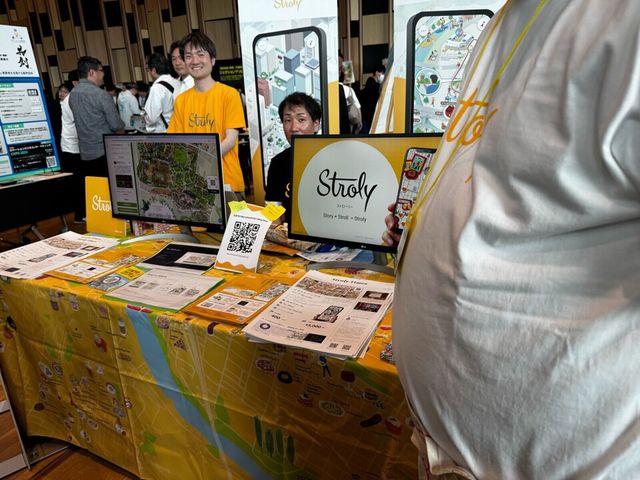
This was the one that got me most excited.
A while ago I went on a trip to Okage Yokocho in Ise, and there was this pictorial-map app I used. I remember being really impressed at the time: "It's an illustrated tourist map, but GPS still works on it, and it's super easy to walk with." At Geo-ten this year I learned that the company behind it is Stroly, and I got a bit excited on my own going "oh, this is who made that map I used back then!"
Stroly has their own technology for tying location information to illustrated maps. The Okage Yokocho digital map is used by about 214,000 people a year, and they've recently added disaster information (AED locations, evacuation points) and multilingual support. The idea of putting tourism and disaster information on the same map layer feels close to what we do with mobility data in the lab.
Other notes
The Cabinet Office had a booth this year for the first time, which made me feel like maps and location information are starting to be taken seriously at the national level too. There were 72 exhibitors total, which is a lot.
Closing
Geo-ten 2026 was my first time attending.
The discussions at our booth, the conversation with MetCom in the evening, and running into Stroly (the company behind a map I had used on a trip years ago) made it a day where I got a lot out of things outside of pure research.
Next year I want to come back on the oral-presentation side, with a follow-up to this year's work to share.
If you'd like to hear more about our research or visit the lab, please come see us.
To contact students, email rikuto☆ucl.nuee.nagoya-u.ac.jp (replace ☆ with @).